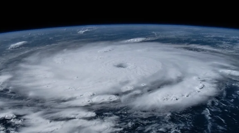
How climate change is rewriting the rules of extreme storms
Photo: Hurricane Beryl was the first category five storm to form in June at the start of the Atlantic hurricane season (Credit: Nasa/Matthew Dominick)
The behaviour of the world’s most powerful storms is evolving. To adapt to more destructive hurricanes, typhoons and tropical cyclones, we need to know how they’re changing.
Fuelled by heat from ocean waters, hurricanes, typhoons and tropical cyclones are sometimes known as nature’s steam engines. As they barrel over the oceans, they turn its heat into brutal kinetic energy that flattens islands and inundates coastal cities, taking months of urgent repair work to heal. Ocean temperatures are now breaking all records, and these “engines” are responding accordingly, cutting different paths across the ocean, slowing down, and becoming less predictable and more dangerous.
Now there’s a race to understand exactly how hurricanes are rewriting the rules and patterns we’ve seen before, in the hope of learning how we can adapt.
A longer season
There’s a distinct seasonal cycle to hurricanes in the Atlantic, with very few or none at all in winter, and a peak in September. A strong, early start to the hurricane season is in line with what we would expect with climate change, says James Kossin, a climate and atmospheric scientist retired from the US National Oceanic and Atmospheric Administration (Noaa).
“Hurricanes themselves just respond to the environment that they’re sitting in,” Kossin says. “And so if you make the environment in June look like the environment that would normally be in August or September, then the hurricanes will simply behave as though it’s August or September. They don’t have a calendar.”
The extraordinarily warm ocean conditions we’re seeing now are driven by climate change, though there are other factors that have made this an active season, such as the present transition from El Nino to La Nina, which tends to boost storm activity.
“In a warming climate, we would expect the waters to be at the warmth that we need for hurricane earlier in the year,” says Kristen Corbosiero, associate professor in the department of atmospheric and environmental sciences at the University at Albany in New York. “So it’s certainly possible that we will see earlier seasons and longer hurricane seasons moving forward.”
While the intense early start to the 2024 season with Hurricane Beryl is in line with what climate scientists might expect to see with climate change, it’s too early to observe a consistent shift in the season. “[It’s] not something that appears clearly in the data yet,” says Suzana Camargo, professor of ocean and climate physics at Columbia University.
‘Shear is death’
One of the strongest storms to form recently in the Atlantic did so under conditions that ought to have prevented a hurricane from forming, says Hugh Willoughby, research professor in earth and environment at Florida International University.
In September 2023, at the peak of the Atlantic season, Hurricane Lee rapidly intensified into a category five storm. At the time, an El Niño was in effect, which generally has a stifling effect on storms in the Atlantic due to greater wind shear and atmospheric stability.
“Shear is death for hurricanes,” says Willoughby. Vertical wind shear is the change in wind speed and direction at different heights – high wind shear disturbs the structure of a hurricane. “Imagine you’ve got a turbine engine – shear knocks some of the blades out,” says Willoughby.
So for a category five like Hurricane Lee to form despite considerable shear came as “a nasty surprise”. The extraordinary ocean warmth in September 2023 may have somehow overwhelmed the influence of shear, says Willoughby, though it’s not entirely clear why.
“We, the theoreticians, need to think about that.”
Faster intensification
The vast majority of hurricanes that form in the Atlantic don’t reach their potential, says Willoughby. In the relatively tight constraints of the Atlantic Basin a storm will often make landfall before it reaches peak intensity, or it will run into high wind shear, which helps dissipate the storm.
“But when everything goes right it’ll intensify rapidly and reach its maximum potential intensity, which is defined by the ocean surface temperature below the hurricane,” says Willoughby.


